GIS, or geographic information systems, are computer-based tools used to store, visualize, analyze, and interpret geographic data. Once a tool used primarily by researchers and scholars in a few areas—notably geographical and sustainable sciences and archeology—GIS has been embraced by faculty, staff, and students across campus.
Multidisciplinary Tool Spans Campus
Adam Skibbe, who serves as the University of Iowa’s lead for all things GIS, has assisted with projects in nearly every college, including unique applications in areas as diverse as dance and medicine.
“It’s a very multidisciplinary tool,” says Skibbe. “We’re literally getting requests from every corner of campus.”
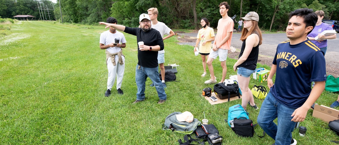
Skibbe leads ICIGO—the Iowa Community Integrated Geography Organization—a student organization that is a perennial partner for IISC. Housed in the Department of Geographical and Sustainable Sciences, ICIGO allows students to gain course credits while gaining hands-on experience with GIS applications.
Real World Challenges
Some of those projects ICIGO tackles from IISC partnerships. This year, for example, ICIGO is working on a project for Bondurant, one of IISC’s primary partners for 2023-24, to map the city’s streams and apply appropriate buffer zones to each. The maps will help the city identify undevelopable land surrounding the streams.
Skibbe says that a lot of ICIGO’s work helps to inform policy or development decisions. It’s not uncommon for a group to ask for maps to prove or bolster a supposition. “The goal isn’t necessarily to produce the perfect thing,” he says, “but to provide a proof of concept.”
The challenge for the students is figuring out how to create usable products from sometimes vague requests. “Honestly, some of the hardest projects are the most exciting,” he says.
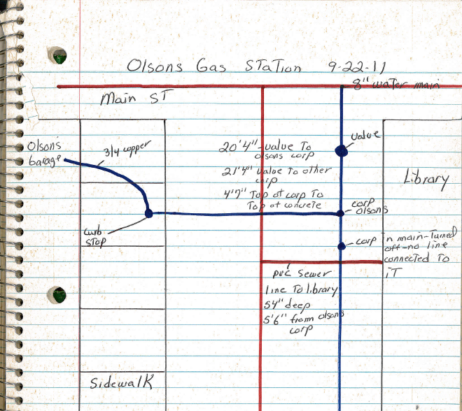
One of the most difficult starting points the group was given were notebooks filled with handwritten notations and drawings that represented all the city of Preston had by way of documentation of existing utilities. ICIGO students georeferenced all the hand drawn information (including notes lost to time, like “Tom’s shed”), digitized the data, and created current, usable maps.
During IISC’s 2020-21 partnership with Waterloo, ICIGO students produced organizational and jurisdictional maps to help citizens identify neighborhood association boundaries, census tracts, voting precincts, and more. Skibbe recalls they were given five different versions of a datafile and had to decipher which was more recent.
“You can easily make fun, colorful maps,” says Skibbe with a mischievous smile, “but this kind of challenge is much closer to what students might have to do in a workplace.”
Growing with the GIS Field
Skibbe’s own career maps on to the trajectory of GIS. After discovering the application during his senior year at the UI more than twenty years ago, he was hired by Facilities Management to identify and map termite activity on campus. “We used blue and red dye in our bait traps to help identify where they were moving from trap to trap.”
He then got a landscape architecture degree from Iowa State University, less out of specific interest in that area and more because the department was a hub for GIS research. He later spent nearly six years as the information manager for the Konza Prairie Long-Term Ecological Research site in Kansas, part of a network of National Science Foundation-funded ecological sites.
Since 2013, Skibbe has been back at the UI where he oversees the same lab in Jessup Hall where he first learned GIS. He is the primary contact on campus for GIS software, including Arc-GIS, and he is the primary conduit between the UI and state, national, and international news, research, and updates regarding GIS.
The ICIGO students he works with relish producing real world solutions and tools for organizations and communities. Their GIS skills are in high demand by IISC’s community partners.
“ICIGO has become an excellent resource for IISC and our partnering communities, taking on multiple collaborations each year,” says Travis Kraus, director of IISC and a faculty member in the School of Planning and Public Affairs. “Some communities seek assistance because they lack the software or capacity to do GIS work themselves, while others are looking for creative ways to analyze complex challenges. We’re very happy and fortunate for the opportunity to connect Adam and ICIGO students with real-world mutually beneficial projects across the state.”